Geolocate

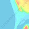
Devbag topographic map

Click on the map to display elevation.

About this map

Name: Devbag topographic map, elevation, terrain.

Location: Devbag, Malvan Taluka, Sindhudurg, Maharashtra, 416523, India (15.95936 73.47523 15.99936 73.51523)

Average elevation: 52 ft

Minimum elevation: -7 ft

Maximum elevation: 525 ft

Other topographic maps

Click on a map to view its topography, its elevation and its terrain.
Dikwal

India > Maharashtra > Malvan Taluka

Average elevation: 338 ft

Tarkarli beach

India > Maharashtra > Malvan Taluka > Tarkarli

Average elevation: 36 ft

Gear up for your next adventure:

🎒Hydration Pack - Hands‑free water reservoir for long hikes
🧥Waterproof Jacket for Hiking - Breathable and rugged rain jacket for outdoor excursions
👟Men's Trail Runners - Lightweight footwear for fast-paced exploration and light hiking
🌐World Map Poster - Decorative world maps with topographic info
🚑Emergency Bivvies - Heat-reflective sleeping bags for survival situations

As an Amazon Associate, this site earns from qualifying purchases at no extra cost to you.