Geolocate

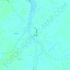
Minnesott Beach topographic map

Click on the map to display elevation.

About this map

Name: Minnesott Beach topographic map, elevation, terrain.

Location: Minnesott Beach, Pamlico County, North Carolina, United States (34.96426 -76.85139 35.00932 -76.79351)

Average elevation: 16 ft

Minimum elevation: -7 ft

Maximum elevation: 52 ft

Pamlico County trails, hiking, mountain biking, running and outdoor activities

Other topographic maps

Click on a map to view its topography, its elevation and its terrain.

Pamlico

United States > North Carolina > Pamlico County

Average elevation: 7 ft

Merritt

United States > North Carolina > Pamlico County

Average elevation: 7 ft

Gear up for your next adventure:

🖼️Topo Map Wall Art - Decorative topographic prints of famous peaks and regions
🎒Outdoor Daypacks - Lightweight backpacks designed for carrying maps and essential gear
🔋Rechargeable Batteries - Power up your outdoor devices
🎒Trekking Poles - Sturdy poles for balance and stability on rough terrain
📦Gear Storage Bags - Organize and protect outdoor equipment

As an Amazon Associate, this site earns from qualifying purchases at no extra cost to you.