
Thank you for supporting this site ❤️
Make a donation
Make a donation
Gear up for your next adventure:
As an Amazon Associate, this site earns from qualifying purchases at no extra cost to you.
Ricaurte topographic map
Click on the map to display elevation.
Thank you for supporting this site ❤️
Make a donation
Make a donation
Gear up for your next adventure:
As an Amazon Associate, this site earns from qualifying purchases at no extra cost to you.
About this map
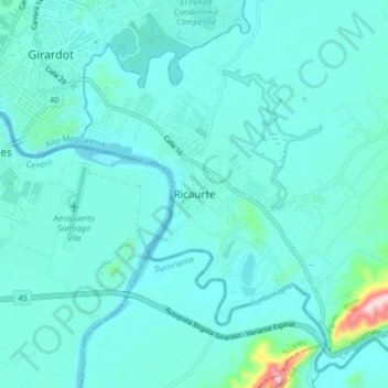
Name: Ricaurte topographic map, elevation, terrain.
Location: Ricaurte, Cundinamarca, 252432434, Colombia (4.23774 -74.81182 4.31774 -74.73182)
Average elevation: 951 ft
Minimum elevation: 817 ft
Maximum elevation: 2,018 ft
Thank you for supporting this site ❤️
Make a donation
Make a donation
Gear up for your next adventure:
As an Amazon Associate, this site earns from qualifying purchases at no extra cost to you.