
Thank you for supporting this site ❤️
Make a donation
Make a donation
Gear up for your next adventure:
As an Amazon Associate, this site earns from qualifying purchases at no extra cost to you.
Pietralta topographic map
Click on the map to display elevation.
Thank you for supporting this site ❤️
Make a donation
Make a donation
Gear up for your next adventure:
As an Amazon Associate, this site earns from qualifying purchases at no extra cost to you.
About this map
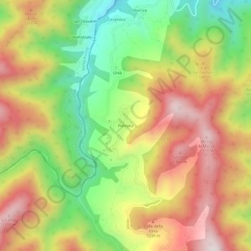
Name: Pietralta topographic map, elevation, terrain.
Location: Pietralta, Valle Castellana, Teramo, Abruzzo, Italia (42.69026 13.42760 42.73026 13.46760)
Average elevation: 3,461 ft
Minimum elevation: 2,352 ft
Maximum elevation: 4,560 ft
Thank you for supporting this site ❤️
Make a donation
Make a donation
Gear up for your next adventure:
As an Amazon Associate, this site earns from qualifying purchases at no extra cost to you.