
Thank you for supporting this site ❤️
Make a donation
Make a donation
Gear up for your next adventure:
As an Amazon Associate, this site earns from qualifying purchases at no extra cost to you.
Drense topographic map
Click on the map to display elevation.
Thank you for supporting this site ❤️
Make a donation
Make a donation
Gear up for your next adventure:
As an Amazon Associate, this site earns from qualifying purchases at no extra cost to you.
About this map
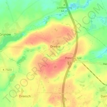
Name: Drense topographic map, elevation, terrain.
Location: Drense, Grünow, Gramzow, Uckermark, Brandenburg, Deutschland (53.29487 13.94764 53.32436 14.01388)
Average elevation: 220 ft
Minimum elevation: 135 ft
Maximum elevation: 289 ft
Thank you for supporting this site ❤️
Make a donation
Make a donation
Gear up for your next adventure:
As an Amazon Associate, this site earns from qualifying purchases at no extra cost to you.