
Make a donation
Gear up for your next adventure:
As an Amazon Associate, this site earns from qualifying purchases at no extra cost to you.
Jamiolle topographic map
Click on the map to display elevation.
Make a donation
Gear up for your next adventure:
As an Amazon Associate, this site earns from qualifying purchases at no extra cost to you.
About this map
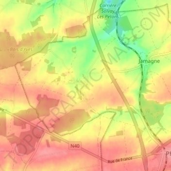
Name: Jamiolle topographic map, elevation, terrain.
Location: Jamiolle, Philippeville, Namen, Wallonië, 5600, België (50.19224 4.48790 50.23224 4.52790)
Average elevation: 850 ft
Minimum elevation: 682 ft
Maximum elevation: 955 ft
Make a donation
Gear up for your next adventure:
As an Amazon Associate, this site earns from qualifying purchases at no extra cost to you.
Other topographic maps
Click on a map to view its topography, its elevation and its terrain.
Make a donation
Gear up for your next adventure:
As an Amazon Associate, this site earns from qualifying purchases at no extra cost to you.
Carrière de la Rochefontaine
België > Namen > Philippeville > Philippeville > Franchimont
Average elevation: 781 ft