
Thank you for supporting this site ❤️
Make a donation
Make a donation
Gear up for your next adventure:
As an Amazon Associate, this site earns from qualifying purchases at no extra cost to you.
الوهدة topographic map
Click on the map to display elevation.
Thank you for supporting this site ❤️
Make a donation
Make a donation
Gear up for your next adventure:
As an Amazon Associate, this site earns from qualifying purchases at no extra cost to you.
About this map
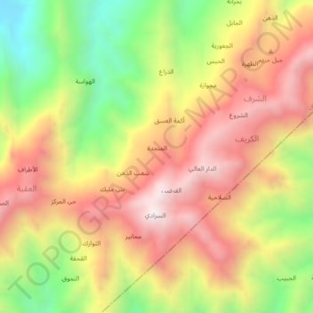
Name: الوهدة topographic map, elevation, terrain.
Location: الوهدة, الكريف, Hazm al Udayn, Ibb, Jemen (14.07853 43.85557 14.11853 43.89557)
Average elevation: 4,770 ft
Minimum elevation: 2,982 ft
Maximum elevation: 6,280 ft
Thank you for supporting this site ❤️
Make a donation
Make a donation
Gear up for your next adventure:
As an Amazon Associate, this site earns from qualifying purchases at no extra cost to you.