Geolocate

Maglinao topographic map

Click on the map to display elevation.

About this map

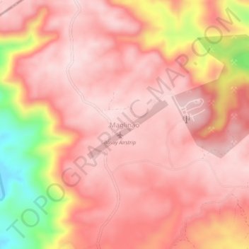
Name: Maglinao topographic map, elevation, terrain.

Location: Maglinao, Basay, Negros Oriental, Central Visayas, Philippines (9.45049 122.64101 9.49049 122.68101)

Average elevation: 876 ft

Minimum elevation: 66 ft

Maximum elevation: 1,155 ft

Gear up for your next adventure:

🦶Carbon Trekking Poles - Reduce knee impact on steep descents with ultra-light poles
🧭Pro Hiking Compasses - High-accuracy liquid-filled compasses for topographic orientation
🧤Tactile Hiking Gloves - Keep hands warm while operating GPS and smartphone screens
🪵Folding Camp Saw - Compact saw for wood and campsite work
🔥Camping Stove - Portable stove for camping and backcountry cooking

As an Amazon Associate, this site earns from qualifying purchases at no extra cost to you.