
Tenlaba topographic map
Click on the map to display elevation.
About this map
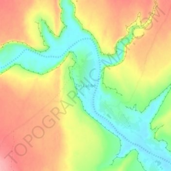
Name: Tenlaba topographic map, elevation, terrain.
Location: Tenlaba, Adrar, Mauritania (20.95156 -11.69439 20.99156 -11.65439)
Average elevation: 1,542 ft
Minimum elevation: 1,348 ft
Maximum elevation: 1,732 ft
Other topographic maps
Click on a map to view its topography, its elevation and its terrain.