
Thank you for supporting this site ❤️
Make a donation
Make a donation
Gear up for your next adventure:
As an Amazon Associate, this site earns from qualifying purchases at no extra cost to you.
Dram topographic map
Click on the map to display elevation.
Thank you for supporting this site ❤️
Make a donation
Make a donation
Gear up for your next adventure:
As an Amazon Associate, this site earns from qualifying purchases at no extra cost to you.
About this map
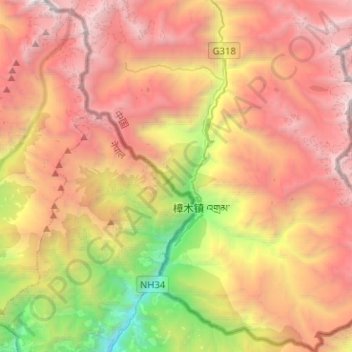
Name: Dram topographic map, elevation, terrain.
Location: Dram, Nyalam County, Shigatse Prefecture, Tibet, China (27.89981 85.89596 28.12328 86.12616)
Average elevation: 12,661 ft
Minimum elevation: 4,183 ft
Maximum elevation: 20,394 ft
Thank you for supporting this site ❤️
Make a donation
Make a donation
Gear up for your next adventure:
As an Amazon Associate, this site earns from qualifying purchases at no extra cost to you.