Geolocate

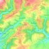
Brimingen topographic map

Click on the map to display elevation.

About this map

Name: Brimingen topographic map, elevation, terrain.

Location: Brimingen, Bitburger Land, Eifelkreis Bitburg-Prüm, Rijnland-Palts, Duitsland (49.95476 6.34330 49.98469 6.39319)

Average elevation: 1,247 ft

Minimum elevation: 965 ft

Maximum elevation: 1,434 ft

Other topographic maps

Click on a map to view its topography, its elevation and its terrain.

Buscht

Duitsland > Rijnland-Palts > Eifelkreis Bitburg-Prüm

Average elevation: 1,234 ft

Gear up for your next adventure:

📦Gear Storage Bags - Organize and protect outdoor equipment
🕶️Glacier Sunglasses - Side shields to protect eyes from high-altitude snow glare
🥤Water Filter Bottle - All‑in‑one filter bottle for safe hydration
📱Solar Portable Charger - Solar power bank for charging devices off‑grid
🧥Men's Rain Shells - Premium waterproof and breathable jackets for mountain weather

As an Amazon Associate, this site earns from qualifying purchases at no extra cost to you.