
Thank you for supporting this site ❤️
Make a donation
Make a donation
Gear up for your next adventure:
As an Amazon Associate, this site earns from qualifying purchases at no extra cost to you.
Centennial topographic map
Click on the map to display elevation.
Thank you for supporting this site ❤️
Make a donation
Make a donation
Gear up for your next adventure:
As an Amazon Associate, this site earns from qualifying purchases at no extra cost to you.
About this map
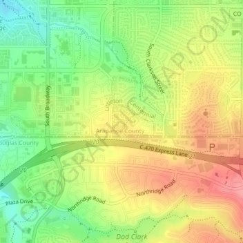
Name: Centennial topographic map, elevation, terrain.
Location: Centennial, Arapahoe County, Colorado, United States (39.56608 -104.97933 39.56940 -104.97583)
Average elevation: 5,650 ft
Minimum elevation: 5,499 ft
Maximum elevation: 5,794 ft
Thank you for supporting this site ❤️
Make a donation
Make a donation
Gear up for your next adventure:
As an Amazon Associate, this site earns from qualifying purchases at no extra cost to you.