
Thank you for supporting this site ❤️
Make a donation
Make a donation
Gear up for your next adventure:
As an Amazon Associate, this site earns from qualifying purchases at no extra cost to you.
Kilgoris topographic map
Click on the map to display elevation.
Thank you for supporting this site ❤️
Make a donation
Make a donation
Gear up for your next adventure:
As an Amazon Associate, this site earns from qualifying purchases at no extra cost to you.
About this map
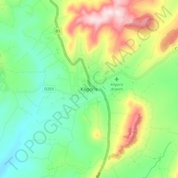
Name: Kilgoris topographic map, elevation, terrain.
Location: Kilgoris, Shankoe ward, Transmara West, Narok, Kenya (-1.04839 34.84001 -0.96839 34.92001)
Average elevation: 5,981 ft
Minimum elevation: 5,433 ft
Maximum elevation: 6,998 ft
Thank you for supporting this site ❤️
Make a donation
Make a donation
Gear up for your next adventure:
As an Amazon Associate, this site earns from qualifying purchases at no extra cost to you.