
Thank you for supporting this site ❤️
Make a donation
Make a donation
Gear up for your next adventure:
As an Amazon Associate, this site earns from qualifying purchases at no extra cost to you.
Chetaibi topographic map
Click on the map to display elevation.
Thank you for supporting this site ❤️
Make a donation
Make a donation
Gear up for your next adventure:
As an Amazon Associate, this site earns from qualifying purchases at no extra cost to you.
About this map
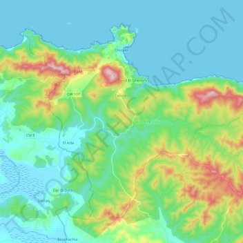
Name: Chetaibi topographic map, elevation, terrain.
Location: Chetaibi, Chetaibi District, Annaba, Algeria (36.93909 7.28477 37.08495 7.50984)
Average elevation: 443 ft
Minimum elevation: -3 ft
Maximum elevation: 2,572 ft
Thank you for supporting this site ❤️
Make a donation
Make a donation
Gear up for your next adventure:
As an Amazon Associate, this site earns from qualifying purchases at no extra cost to you.