Geolocate

Wertheim topographic map

Click on the map to display elevation.

About this map

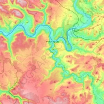
Name: Wertheim topographic map, elevation, terrain.

Location: Wertheim, Main-Tauber-Kreis, Baden-Württemberg, 97877, Germany (49.69270 9.36774 49.79129 9.65199)

Average elevation: 928 ft

Minimum elevation: 417 ft

Maximum elevation: 1,509 ft

Gear up for your next adventure:

🛌Ultralight Sleeping Bags - Compact down bags for cold nights in the wilderness
Solar GPS Watches - Advanced multisport watches with built-in topographic maps
🛰️Satellite Messengers - Emergency SOS and two-way messaging for off-grid adventures
🧢Outdoor Hiking Hat - Sun protection hat for outdoor explorers
🔪Outdoor Multitools - Essential survival tools for gear repair and field use

As an Amazon Associate, this site earns from qualifying purchases at no extra cost to you.