Geolocate

Byron topographic map

Click on the map to display elevation.

About this map

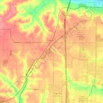
Name: Byron topographic map, elevation, terrain.

Location: Byron, Peach County, Georgia, 31008, United States (32.59341 -83.78810 32.69255 -83.71855)

Average elevation: 463 ft

Minimum elevation: 259 ft

Maximum elevation: 574 ft

Peach County trails, hiking, mountain biking, running and outdoor activities

Gear up for your next adventure:

🦶Hiking Gaiters - Keep debris and water out of your boots
🥄Camping Utensil Set - Lightweight utensils for outdoor meals
🥇GPS Hiking Watch - Multi‑sport GPS watch with navigation and trail tracking
🧣Hiking Neck Gaiter - Multi‑use neck protection for outdoor weather
👖Convertible Hiking Pants - Versatile zip-off pants for changing altitudes and temperatures

As an Amazon Associate, this site earns from qualifying purchases at no extra cost to you.