
Thank you for supporting this site ❤️
Make a donation
Make a donation
Gear up for your next adventure:
As an Amazon Associate, this site earns from qualifying purchases at no extra cost to you.
British topographic map
Click on the map to display elevation.
Thank you for supporting this site ❤️
Make a donation
Make a donation
Gear up for your next adventure:
As an Amazon Associate, this site earns from qualifying purchases at no extra cost to you.
About this map
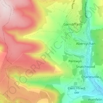
Name: British topographic map, elevation, terrain.
Location: British, Abersychan, Torfaen, Wales, NP4 7US, United Kingdom (51.70524 -3.10110 51.74524 -3.06110)
Average elevation: 1,079 ft
Minimum elevation: 456 ft
Maximum elevation: 1,795 ft
Thank you for supporting this site ❤️
Make a donation
Make a donation
Gear up for your next adventure:
As an Amazon Associate, this site earns from qualifying purchases at no extra cost to you.