
垛庄镇 topographic map
Interactive map
Click on the map to display elevation.
About this map
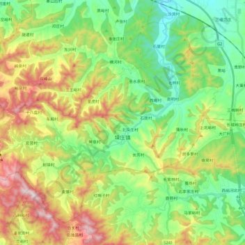
Name: 垛庄镇 topographic map, elevation, terrain.
Location: 垛庄镇, 章丘区, 济南市, 山东省, 中国 (36.43676 117.30047 36.57391 117.50832)
Average elevation: 1,391 ft
Minimum elevation: 499 ft
Maximum elevation: 2,969 ft
Other topographic maps
Click on a map to view its topography, its elevation and its terrain.