Geolocate

Neffe topographic map

Click on the map to display elevation.

About this map
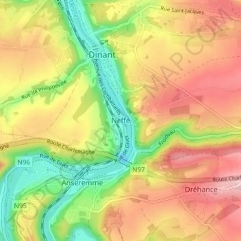
Name: Neffe topographic map, elevation, terrain.

Location: Neffe, Dinant, Namur, Wallonia, 5500, Belgium (50.22827 4.89788 50.26827 4.93788)

Average elevation: 604 ft

Minimum elevation: 246 ft

Maximum elevation: 938 ft

Other topographic maps

Click on a map to view its topography, its elevation and its terrain.

Anseremme

Belgium > Namur > Dinant > Dinant

Average elevation: 551 ft

Dréhance

Belgium > Namur > Dinant > Dinant

Average elevation: 643 ft

Gear up for your next adventure:

📦Gear Storage Bags - Organize and protect outdoor equipment
🏕️Tent Footprint - Protect your tent base from wear
🧤Hiking Gloves - Protective gloves for rugged trails
🏕️Family Camping Gear - Essentials for group camping trips
🌐World Map Poster - Decorative world maps with topographic info

As an Amazon Associate, this site earns from qualifying purchases at no extra cost to you.