Geolocate

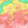
Anseremme topographic map

Click on the map to display elevation.

About this map

Name: Anseremme topographic map, elevation, terrain.

Location: Anseremme, Dinant, Namur, Wallonia, 5500, Belgium (50.21190 4.88798 50.24970 4.92885)

Average elevation: 551 ft

Minimum elevation: 246 ft

Maximum elevation: 866 ft

Other topographic maps

Click on a map to view its topography, its elevation and its terrain.
Dinant

Belgium > Namur > Dinant > Dinant

Average elevation: 669 ft

Falmagne

Belgium > Namur > Dinant > Dinant

Average elevation: 735 ft

Neffe

Belgium > Namur > Dinant > Dinant

Average elevation: 604 ft

Gear up for your next adventure:

🩹Survival Bandages - High‑quality bandages for emergencies
🛌Ultralight Sleeping Bags - Compact down bags for cold nights in the wilderness
🎒Trekking Poles - Sturdy poles for balance and stability on rough terrain
📷Action Camera - Capture your outdoor adventures in HD
📦Gear Storage Bags - Organize and protect outdoor equipment

As an Amazon Associate, this site earns from qualifying purchases at no extra cost to you.