
Thank you for supporting this site ❤️
Make a donation
Make a donation
Gear up for your next adventure:
As an Amazon Associate, this site earns from qualifying purchases at no extra cost to you.
Joanet topographic map
Click on the map to display elevation.
Thank you for supporting this site ❤️
Make a donation
Make a donation
Gear up for your next adventure:
As an Amazon Associate, this site earns from qualifying purchases at no extra cost to you.
About this map
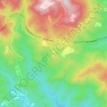
Name: Joanet topographic map, elevation, terrain.
Location: Joanet, Arbúcies, la Selva, Gerona, Cataluña, 17401, España (41.82382 2.50785 41.86382 2.54785)
Average elevation: 1,696 ft
Minimum elevation: 984 ft
Maximum elevation: 2,608 ft
Thank you for supporting this site ❤️
Make a donation
Make a donation
Gear up for your next adventure:
As an Amazon Associate, this site earns from qualifying purchases at no extra cost to you.