
Junction topographic map
Click on the map to display elevation.
About this map
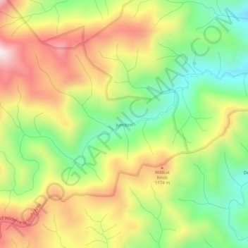
Name: Junction topographic map, elevation, terrain.
Location: Junction, Graham County, North Carolina, United States (35.24509 -83.95768 35.28509 -83.91768)
Average elevation: 3,314 ft
Minimum elevation: 2,431 ft
Maximum elevation: 4,334 ft
Graham County trails, hiking, mountain biking, running and outdoor activities
Other topographic maps
Click on a map to view its topography, its elevation and its terrain.
Lake Santeetlah
United States > North Carolina > Graham County > Lake Santeetlah
Average elevation: 2,083 ft