
Thank you for supporting this site ❤️
Make a donation
Make a donation
Gear up for your next adventure:
As an Amazon Associate, this site earns from qualifying purchases at no extra cost to you.
Downlands topographic map
Click on the map to display elevation.
Thank you for supporting this site ❤️
Make a donation
Make a donation
Gear up for your next adventure:
As an Amazon Associate, this site earns from qualifying purchases at no extra cost to you.
About this map
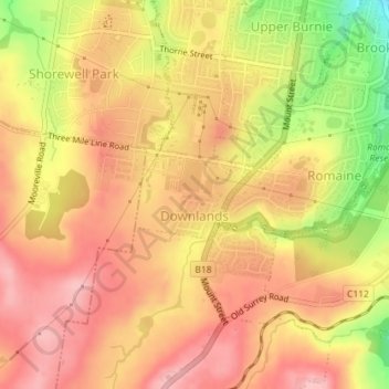
Name: Downlands topographic map, elevation, terrain.
Location: Downlands, Burnie, City of Burnie, Tasmania, Australia (-41.08584 145.88547 -41.07957 145.89669)
Average elevation: 512 ft
Minimum elevation: 203 ft
Maximum elevation: 679 ft
Thank you for supporting this site ❤️
Make a donation
Make a donation
Gear up for your next adventure:
As an Amazon Associate, this site earns from qualifying purchases at no extra cost to you.