Geolocate

Delicias topographic map

Click on the map to display elevation.

About this map

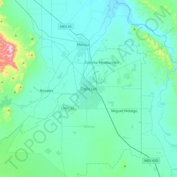
Name: Delicias topographic map, elevation, terrain.

Location: Delicias, Chihuahua, 33080, Mexico (28.03098 -105.62943 28.35098 -105.30943)

Average elevation: 4,012 ft

Minimum elevation: 3,668 ft

Maximum elevation: 6,709 ft

Gear up for your next adventure:

🛠️Backpacking Tool Kit - Essential toolkit for outdoor repairs
🔌Solar Panel Charger - Charge gear sustainably outdoors
📖Nature Tracking Books - Learn to track wildlife and terrain
🛰️Satellite Messengers - Emergency SOS and two-way messaging for off-grid adventures
🔋Solar Power Banks - Keep your GPS and phone charged in remote wilderness areas

As an Amazon Associate, this site earns from qualifying purchases at no extra cost to you.