
Thank you for supporting this site ❤️
Make a donation
Make a donation
Gear up for your next adventure:
As an Amazon Associate, this site earns from qualifying purchases at no extra cost to you.
Keitahi topographic map
Click on the map to display elevation.
Thank you for supporting this site ❤️
Make a donation
Make a donation
Gear up for your next adventure:
As an Amazon Associate, this site earns from qualifying purchases at no extra cost to you.
About this map
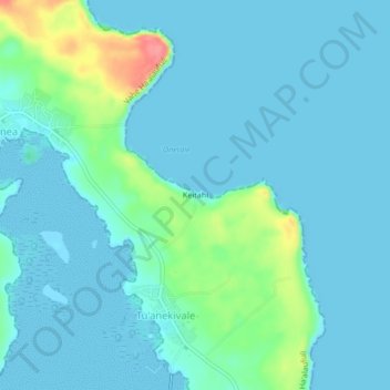
Name: Keitahi topographic map, elevation, terrain.
Location: Keitahi, Tu'anekivale, Vahe Ha'alaufuli, Vavaʻu, Tonga (-18.63606 -173.93610 -18.59606 -173.89610)
Average elevation: 39 ft
Minimum elevation: -3 ft
Maximum elevation: 256 ft
Thank you for supporting this site ❤️
Make a donation
Make a donation
Gear up for your next adventure:
As an Amazon Associate, this site earns from qualifying purchases at no extra cost to you.