Geolocate

Hansted topographic map

Click on the map to display elevation.

About this map
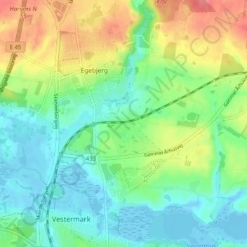
Name: Hansted topographic map, elevation, terrain.

Location: Hansted, Horsens, Horsens Kommune, Region Midtjylland, 8700, Danmark (55.87436 9.82847 55.91436 9.86847)

Average elevation: 85 ft

Minimum elevation: -16 ft

Maximum elevation: 243 ft

Other topographic maps

Click on a map to view its topography, its elevation and its terrain.

Nørrestrand

Danmark > Region Midtjylland > Horsens

Average elevation: 46 ft

Vorsø

Danmark > Region Midtjylland > Horsens

Average elevation: 0 ft

Bygholm Å

Danmark > Region Midtjylland > Horsens

Average elevation: 79 ft

Gear up for your next adventure:

🧥Waterproof Jacket for Hiking - Breathable and rugged rain jacket for outdoor excursions
🔭Stargazing Telescopes - Perfect for camping in low-light pollution areas shown on maps
🚪Portable Camp Chair - Foldable chair for comfort at camp
⛺Backpacking Tents - Weight-optimized shelters for multi-day topographic surveys
🚁Photography Drones - Capture stunning aerial views of landforms and topography

As an Amazon Associate, this site earns from qualifying purchases at no extra cost to you.