Geolocate

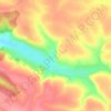
Mylivtsi topographic map

Click on the map to display elevation.

About this map

Name: Mylivtsi topographic map, elevation, terrain.

Location: Mylivtsi, Nahirianka Rural Hromada, Chortkiv Raion, Ternopil Oblast, 48564, Ukraine (48.87451 25.78275 48.89331 25.83778)

Average elevation: 801 ft

Minimum elevation: 617 ft

Maximum elevation: 1,010 ft

Other topographic maps

Click on a map to view its topography, its elevation and its terrain.
Hodiv

Ukraine > Ternopil Oblast

Average elevation: 1,217 ft

Gear up for your next adventure:

🔪Outdoor Multitools - Essential survival tools for gear repair and field use
🔦Powerful Headlamps - Ultra-bright hands-free lighting for night navigation
👟Men's Trail Runners - Lightweight footwear for fast-paced exploration and light hiking
💧Water Purification System - Clean water on the trail with reliable purifiers
🕶️GPS Smartphone Mount - Secure mount for phone navigation

As an Amazon Associate, this site earns from qualifying purchases at no extra cost to you.