Geolocate

Donaldson topographic map

Click on the map to display elevation.

About this map

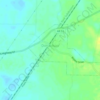
Name: Donaldson topographic map, elevation, terrain.

Location: Donaldson, Hot Spring County, Arkansas, 71941, United States (34.22865 -92.93075 34.24245 -92.90713)

Average elevation: 230 ft

Minimum elevation: 207 ft

Maximum elevation: 269 ft

Hot Spring County trails, hiking, mountain biking, running and outdoor activities

Other topographic maps

Click on a map to view its topography, its elevation and its terrain.

Saginaw

United States > Arkansas > Hot Spring County

Average elevation: 305 ft

Bonnerdale

United States > Arkansas > Hot Spring County

Average elevation: 663 ft

Glen Rose

United States > Arkansas > Hot Spring County

Average elevation: 351 ft

Perla

United States > Arkansas > Hot Spring County > Perla

Average elevation: 358 ft

Lono

United States > Arkansas > Hot Spring County

Average elevation: 463 ft

Gear up for your next adventure:

🏕️Family Camping Gear - Essentials for group camping trips
🧣Hiking Neck Gaiter - Multi‑use neck protection for outdoor weather
🥘Titanium Cookware - Durable, featherlight pots and pans for backpacking
🥾Women's Hiking Boots - Top-rated trail boots with ankle support and superior grip
🧯Portable Fire Pit - Compact fire pit for camping spots

As an Amazon Associate, this site earns from qualifying purchases at no extra cost to you.