Geolocate

Millu topographic map

Click on the map to display elevation.

About this map

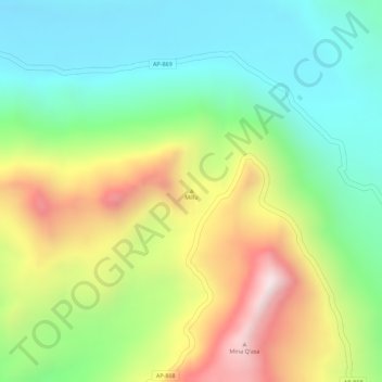
Name: Millu topographic map, elevation, terrain.

Location: Millu, Oropesa, Province of Antabamba, Apurímac, Peru (-14.58288 -72.52005 -14.58278 -72.51995)

Average elevation: 15,922 ft

Minimum elevation: 15,171 ft

Maximum elevation: 17,031 ft

Gear up for your next adventure:

🚁Photography Drones - Capture stunning aerial views of landforms and topography
🌧️Backpack Rain Cover - Keep gear dry in wet weather
🔭Telescopic Hiking Pole - Adjustable pole for hiking stability
🪶Compact Camp Shovel - Folding shovel for campsite tasks
🏫Relief Map Kits - Hands-on tools for teaching landforms and elevation

As an Amazon Associate, this site earns from qualifying purchases at no extra cost to you.