Geolocate

Timbain topographic map

Click on the map to display elevation.

About this map

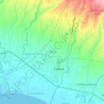
Name: Timbain topographic map, elevation, terrain.

Location: Timbain, Calaca, Batangas, Calabarzon, 4212, Philippines (13.92028 120.79130 13.96028 120.83130)

Average elevation: 144 ft

Minimum elevation: 0 ft

Maximum elevation: 499 ft

Gear up for your next adventure:

🔥Camping Stove - Portable stove for camping and backcountry cooking
📶Satellite Messenger - Communication device off‑grid
🧦Hiking Socks - Comfortable socks to prevent blisters on long hikes
🌧️Backpack Rain Cover - Keep gear dry in wet weather
🦟Ultrasonic Repellers - Create a bug-free zone at your camp or rest stop

As an Amazon Associate, this site earns from qualifying purchases at no extra cost to you.