Geolocate

Koyu topographic map

Click on the map to display elevation.

About this map

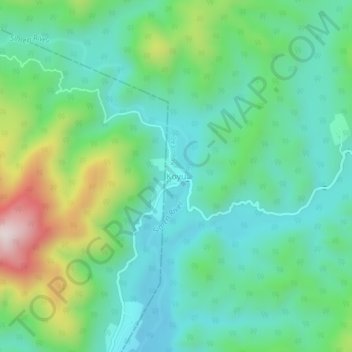
Name: Koyu topographic map, elevation, terrain.

Location: Koyu, Koyu EAC, Lower Siang, Arunachal Pradesh, India (27.95674 94.93425 27.99674 94.97425)

Average elevation: 1,493 ft

Minimum elevation: 955 ft

Maximum elevation: 2,936 ft

Gear up for your next adventure:

🛠️Backpacking Tool Kit - Essential toolkit for outdoor repairs
🪶Wildlife Field Guides - Learn animal tracking and species ID
🏫Relief Map Kits - Hands-on tools for teaching landforms and elevation
🏔️Mountain Trail Maps - High‑detail maps for popular peaks
🔌Solar Panel Charger - Charge gear sustainably outdoors

As an Amazon Associate, this site earns from qualifying purchases at no extra cost to you.