
Proton Station topographic map
Interactive map
Click on the map to display elevation.
About this map
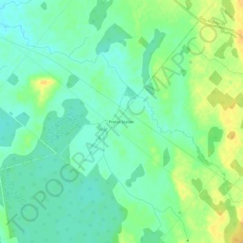
Name: Proton Station topographic map, elevation, terrain.
Average elevation: 1,594 ft
Minimum elevation: 1,558 ft
Maximum elevation: 1,650 ft
Other topographic maps
Click on a map to view its topography, its elevation and its terrain.
Dundalk
Canada > Ontario > Grey County > Southgate
Dundalk, Southgate, Grey County, Ontario, N0C 1B0, Canada
Average elevation: 1,693 ft