
Ruhstorf topographic map
Interactive map
Click on the map to display elevation.
About this map
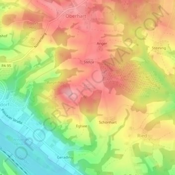
Name: Ruhstorf topographic map, elevation, terrain.
Location: Ruhstorf, Windorf, Landkreis Passau, Bayern, Deutschland (48.62581 13.24427 48.62697 13.24685)
Average elevation: 1,234 ft
Minimum elevation: 974 ft
Maximum elevation: 1,440 ft