
Thank you for supporting this site ❤️
Make a donation
Make a donation
Gear up for your next adventure:
As an Amazon Associate, this site earns from qualifying purchases at no extra cost to you.
Breithorn topographic map
Click on the map to display elevation.
Thank you for supporting this site ❤️
Make a donation
Make a donation
Gear up for your next adventure:
As an Amazon Associate, this site earns from qualifying purchases at no extra cost to you.
About this map
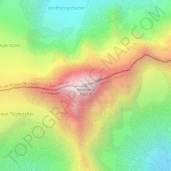
Name: Breithorn topographic map, elevation, terrain.
Location: Breithorn, Blatten, Westlich Raron, Wallis, 3919, Schweiz (46.47843 7.87720 46.47853 7.87730)
Average elevation: 9,560 ft
Minimum elevation: 7,428 ft
Maximum elevation: 12,362 ft
Thank you for supporting this site ❤️
Make a donation
Make a donation
Gear up for your next adventure:
As an Amazon Associate, this site earns from qualifying purchases at no extra cost to you.