
Thank you for supporting this site ❤️
Make a donation
Make a donation
Gear up for your next adventure:
As an Amazon Associate, this site earns from qualifying purchases at no extra cost to you.
Greith topographic map
Click on the map to display elevation.
Thank you for supporting this site ❤️
Make a donation
Make a donation
Gear up for your next adventure:
As an Amazon Associate, this site earns from qualifying purchases at no extra cost to you.
About this map
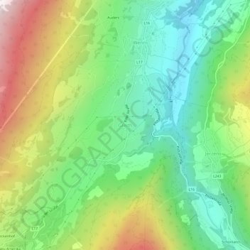
Name: Greith topographic map, elevation, terrain.
Location: Greith, Gemeinde Wenns, Bezirk Imst, Tirol, 6473, Österreich (47.13567 10.70620 47.17567 10.74620)
Average elevation: 4,121 ft
Minimum elevation: 2,690 ft
Maximum elevation: 6,588 ft
Thank you for supporting this site ❤️
Make a donation
Make a donation
Gear up for your next adventure:
As an Amazon Associate, this site earns from qualifying purchases at no extra cost to you.