Geolocate

Windemere topographic map

Click on the map to display elevation.

About this map

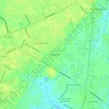
Name: Windemere topographic map, elevation, terrain.

Location: Windemere, Wilmington, New Hanover County, North Carolina, 28405, United States (34.22045 -77.86360 34.26045 -77.82360)

Average elevation: 33 ft

Minimum elevation: -3 ft

Maximum elevation: 52 ft

Other topographic maps

Click on a map to view its topography, its elevation and its terrain.

Gear up for your next adventure:

🗻Climbing Gear Basics - Essential gear for beginner climbers
🥾Women's Hiking Boots - Top-rated trail boots with ankle support and superior grip
📻Weather Alert Radios - Stay informed of storm risks while off-the-grid
📶Satellite Messenger - Communication device off‑grid
🎒Trekking Poles - Sturdy poles for balance and stability on rough terrain

As an Amazon Associate, this site earns from qualifying purchases at no extra cost to you.