
Thank you for supporting this site ❤️
Make a donation
Make a donation
Gear up for your next adventure:
As an Amazon Associate, this site earns from qualifying purchases at no extra cost to you.
Oncheon-dong topographic map
Click on the map to display elevation.
Thank you for supporting this site ❤️
Make a donation
Make a donation
Gear up for your next adventure:
As an Amazon Associate, this site earns from qualifying purchases at no extra cost to you.
About this map
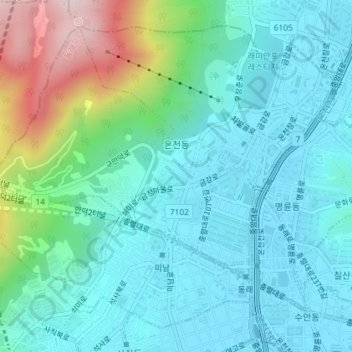
Name: Oncheon-dong topographic map, elevation, terrain.
Location: Oncheon-dong, Dongnae-gu, Busan, South Korea (35.20045 129.05097 35.22588 129.08705)
Average elevation: 387 ft
Minimum elevation: 13 ft
Maximum elevation: 1,726 ft
Thank you for supporting this site ❤️
Make a donation
Make a donation
Gear up for your next adventure:
As an Amazon Associate, this site earns from qualifying purchases at no extra cost to you.