
Thank you for supporting this site ❤️
Make a donation
Make a donation
Gear up for your next adventure:
As an Amazon Associate, this site earns from qualifying purchases at no extra cost to you.
Tailfer topographic map
Click on the map to display elevation.
Thank you for supporting this site ❤️
Make a donation
Make a donation
Gear up for your next adventure:
As an Amazon Associate, this site earns from qualifying purchases at no extra cost to you.
About this map
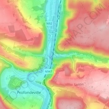
Name: Tailfer topographic map, elevation, terrain.
Location: Tailfer, Lustin, Profondeville, Namur, Wallonie, 5170, Belgique (50.37015 4.86230 50.41015 4.90230)
Average elevation: 604 ft
Minimum elevation: 249 ft
Maximum elevation: 896 ft
Thank you for supporting this site ❤️
Make a donation
Make a donation
Gear up for your next adventure:
As an Amazon Associate, this site earns from qualifying purchases at no extra cost to you.