
Thank you for supporting this site ❤️
Make a donation
Make a donation
Gear up for your next adventure:
As an Amazon Associate, this site earns from qualifying purchases at no extra cost to you.
Dammaj topographic map
Click on the map to display elevation.
Thank you for supporting this site ❤️
Make a donation
Make a donation
Gear up for your next adventure:
As an Amazon Associate, this site earns from qualifying purchases at no extra cost to you.
About this map
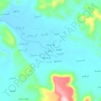
Name: Dammaj topographic map, elevation, terrain.
Location: Dammaj, As Safra district, Sa'dah Governorate, Yemen (16.86758 43.79263 16.90758 43.83263)
Average elevation: 6,368 ft
Minimum elevation: 6,201 ft
Maximum elevation: 7,106 ft
Thank you for supporting this site ❤️
Make a donation
Make a donation
Gear up for your next adventure:
As an Amazon Associate, this site earns from qualifying purchases at no extra cost to you.