
Make a donation
Gear up for your next adventure:
As an Amazon Associate, this site earns from qualifying purchases at no extra cost to you.
Schriek topographic map
Click on the map to display elevation.
Make a donation
Gear up for your next adventure:
As an Amazon Associate, this site earns from qualifying purchases at no extra cost to you.
Schriek
De deelgemeente heeft een oppervlakte van 11,09 km². Het centrum van de deelgemeente is gelegen op een hoogte van ongeveer 12 meter TAW. Het landschap rondom is relatief vlak en kent ongeveer dezelfde hoogte.
Make a donation
Gear up for your next adventure:
As an Amazon Associate, this site earns from qualifying purchases at no extra cost to you.
About this map
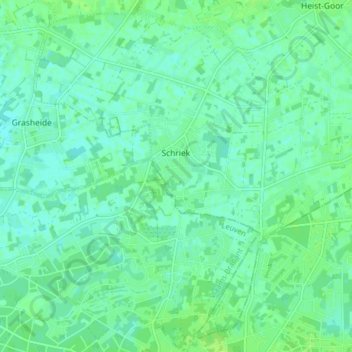
Name: Schriek topographic map, elevation, terrain.
Location: Schriek, Heist-op-den-Berg, Mechelen, Antwerpen, 2223, België (50.99859 4.65903 51.04464 4.73802)
Average elevation: 36 ft
Minimum elevation: 20 ft
Maximum elevation: 49 ft
Make a donation
Gear up for your next adventure:
As an Amazon Associate, this site earns from qualifying purchases at no extra cost to you.
Other topographic maps
Click on a map to view its topography, its elevation and its terrain.
Make a donation
Gear up for your next adventure:
As an Amazon Associate, this site earns from qualifying purchases at no extra cost to you.
Make a donation
Gear up for your next adventure:
As an Amazon Associate, this site earns from qualifying purchases at no extra cost to you.