
Thank you for supporting this site ❤️
Make a donation
Make a donation
Gear up for your next adventure:
As an Amazon Associate, this site earns from qualifying purchases at no extra cost to you.
Iejima topographic map
Click on the map to display elevation.
Thank you for supporting this site ❤️
Make a donation
Make a donation
Gear up for your next adventure:
As an Amazon Associate, this site earns from qualifying purchases at no extra cost to you.
About this map
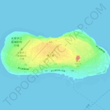
Name: Iejima topographic map, elevation, terrain.
Location: Iejima, Ie, Kunigami, Okinawa Prefecture, Japan (26.70451 127.74892 26.73912 127.83153)
Average elevation: 49 ft
Minimum elevation: 0 ft
Maximum elevation: 407 ft
Thank you for supporting this site ❤️
Make a donation
Make a donation
Gear up for your next adventure:
As an Amazon Associate, this site earns from qualifying purchases at no extra cost to you.