Geolocate

Papucín topographic map

Click on the map to display elevation.

About this map

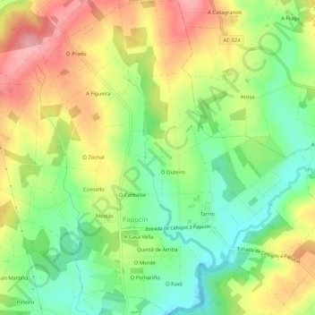
Name: Papucín topographic map, elevation, terrain.

Location: Papucín, Frades, Ordes, La Coruña, Galicia, España (43.04572 -8.29172 43.08339 -8.24346)

Average elevation: 1,198 ft

Minimum elevation: 1,007 ft

Maximum elevation: 1,424 ft

Other topographic maps

Click on a map to view its topography, its elevation and its terrain.

Tarrío

España > Galicia > Ordes > Papucín

Average elevation: 1,155 ft

Gear up for your next adventure:

🛠️Outdoor Gear Repair Kit - Essential tools to fix gear on the trail
🏕️Tent Footprint - Protect your tent base from wear
😴Insulated Sleeping Pads - Compact and warm pads for high-elevation camping
🚑Emergency Bivvies - Heat-reflective sleeping bags for survival situations
🪶Thermal Camp Blanket - Extra warmth for cold nights

As an Amazon Associate, this site earns from qualifying purchases at no extra cost to you.