Geolocate

Pierle topographic map

Click on the map to display elevation.

About this map

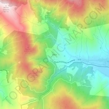
Name: Pierle topographic map, elevation, terrain.

Location: Pierle, Cortona, Arezzo, Tuscany, Italy (43.23777 12.09099 43.27777 12.13099)

Average elevation: 1,867 ft

Minimum elevation: 974 ft

Maximum elevation: 3,031 ft

Gear up for your next adventure:

🧷Carabiner Set - Durable clips for gear attachment
📡Handheld GPS Device - Reliable handheld GPS for outdoor navigation
🕶️GPS Smartphone Mount - Secure mount for phone navigation
🗃️Trail First Aid Kit - Essential kit for outdoor injuries and emergencies
🦟Ultrasonic Repellers - Create a bug-free zone at your camp or rest stop

As an Amazon Associate, this site earns from qualifying purchases at no extra cost to you.