
Thank you for supporting this site ❤️
Make a donation
Make a donation
Gear up for your next adventure:
As an Amazon Associate, this site earns from qualifying purchases at no extra cost to you.
Ubinas topographic map
Click on the map to display elevation.
Thank you for supporting this site ❤️
Make a donation
Make a donation
Gear up for your next adventure:
As an Amazon Associate, this site earns from qualifying purchases at no extra cost to you.
About this map
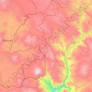
Name: Ubinas topographic map, elevation, terrain.
Location: Ubinas, General Sánchez Cerro, Moquegua, Perú (-16.44751 -70.98656 -15.97596 -70.65599)
Average elevation: 14,324 ft
Minimum elevation: 8,396 ft
Maximum elevation: 18,428 ft
Thank you for supporting this site ❤️
Make a donation
Make a donation
Gear up for your next adventure:
As an Amazon Associate, this site earns from qualifying purchases at no extra cost to you.