Jamagne topographic map
Interactive map
Click on the map to display elevation.
About this map
![Jamagne topographic map, elevation, terrain](/pub/maps/node/gwnx/d4t6lzs8/thumbnail.jpg)
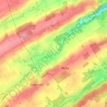
Name: Jamagne topographic map, elevation, terrain.
Location: Jamagne, Marchin, Huy, Liège, Wallonie, 4570, Belgique (50.43170 5.21175 50.47170 5.25175)
Average elevation: 764 ft
Minimum elevation: 538 ft
Maximum elevation: 922 ft
Other topographic maps
Click on a map to view its topography, its elevation and its terrain.
![Grand-Marchin topographic map, elevation, terrain](/pub/maps/node/3nz4/fwh6h83l/icon.jpg)
Grand-Marchin
Belgique > Liège > Huy > Marchin
Grand-Marchin, Marchin, Huy, Liège, Wallonie, 4570, Belgique
Average elevation: 738 ft