
Thank you for supporting this site ❤️
Make a donation
Make a donation
Gear up for your next adventure:
As an Amazon Associate, this site earns from qualifying purchases at no extra cost to you.
Valmarino topographic map
Click on the map to display elevation.
Thank you for supporting this site ❤️
Make a donation
Make a donation
Gear up for your next adventure:
As an Amazon Associate, this site earns from qualifying purchases at no extra cost to you.
About this map
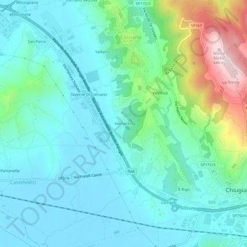
Name: Valmarino topographic map, elevation, terrain.
Location: Valmarino, Chiugiana, Corciano, Perugia, Umbria, 06073, Italia (43.09500 12.26616 43.13500 12.30616)
Average elevation: 1,017 ft
Minimum elevation: 712 ft
Maximum elevation: 2,123 ft
Thank you for supporting this site ❤️
Make a donation
Make a donation
Gear up for your next adventure:
As an Amazon Associate, this site earns from qualifying purchases at no extra cost to you.