
Thank you for supporting this site ❤️
Make a donation
Make a donation
Gear up for your next adventure:
As an Amazon Associate, this site earns from qualifying purchases at no extra cost to you.
Cuentepec topographic map
Click on the map to display elevation.
Thank you for supporting this site ❤️
Make a donation
Make a donation
Gear up for your next adventure:
As an Amazon Associate, this site earns from qualifying purchases at no extra cost to you.
About this map
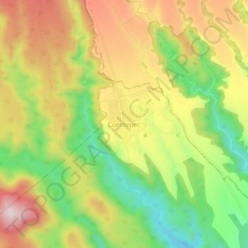
Name: Cuentepec topographic map, elevation, terrain.
Location: Cuentepec, Temixco, Morelos, México (18.84096 -99.34582 18.88096 -99.30582)
Average elevation: 4,744 ft
Minimum elevation: 4,016 ft
Maximum elevation: 5,489 ft
Thank you for supporting this site ❤️
Make a donation
Make a donation
Gear up for your next adventure:
As an Amazon Associate, this site earns from qualifying purchases at no extra cost to you.