Geolocate

Georai topographic map

Click on the map to display elevation.

About this map

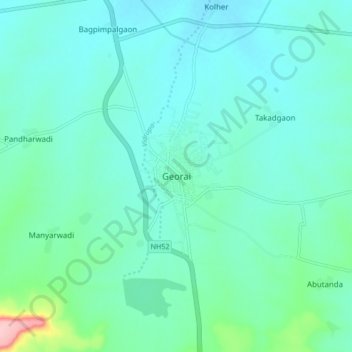
Name: Georai topographic map, elevation, terrain.

Location: Georai, Beed, Maharashtra, 431127, India (19.22253 75.71049 19.30253 75.79049)

Average elevation: 1,522 ft

Minimum elevation: 1,437 ft

Maximum elevation: 1,965 ft

Gear up for your next adventure:

Backpacking Tents - Weight-optimized shelters for multi-day topographic surveys
🔦Powerful Headlamps - Ultra-bright hands-free lighting for night navigation
🏫Relief Map Kits - Hands-on tools for teaching landforms and elevation
🌡️Portable Weather Meter - Track weather conditions on the trail
🚪Portable Camp Chair - Foldable chair for comfort at camp

As an Amazon Associate, this site earns from qualifying purchases at no extra cost to you.