
Thank you for supporting this site ❤️
Make a donation
Make a donation
Gear up for your next adventure:
As an Amazon Associate, this site earns from qualifying purchases at no extra cost to you.
吉利 topographic map
Click on the map to display elevation.
Thank you for supporting this site ❤️
Make a donation
Make a donation
Gear up for your next adventure:
As an Amazon Associate, this site earns from qualifying purchases at no extra cost to you.
About this map
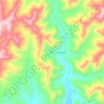
Name: 吉利 topographic map, elevation, terrain.
Location: 吉利, 勒秀镇, 合作市, 甘南藏族自治州, 甘肃省, 中国 (34.77630 102.97200 34.81630 103.01200)
Average elevation: 10,413 ft
Minimum elevation: 9,760 ft
Maximum elevation: 11,181 ft
Thank you for supporting this site ❤️
Make a donation
Make a donation
Gear up for your next adventure:
As an Amazon Associate, this site earns from qualifying purchases at no extra cost to you.