Geolocate

Talamban topographic map

Click on the map to display elevation.

About this map

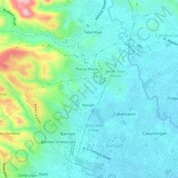
Name: Talamban topographic map, elevation, terrain.

Location: Talamban, Cebu, Central Visayas, 653, Philippines (10.33653 123.89604 10.37653 123.93604)

Average elevation: 200 ft

Minimum elevation: 46 ft

Maximum elevation: 758 ft

Gear up for your next adventure:

🔥Camping Stove - Portable stove for camping and backcountry cooking
📦Gear Storage Bags - Organize and protect outdoor equipment
Solar GPS Watches - Advanced multisport watches with built-in topographic maps
🎒Trekking Poles - Sturdy poles for balance and stability on rough terrain
🎁Geography Themed Gifts - Unique gift ideas for map lovers and geography enthusiasts

As an Amazon Associate, this site earns from qualifying purchases at no extra cost to you.